
Via Shepherd Pass and the West Face Route
Day 1
- Switch backs
- Trail legs?
- Jet fuel
“It’s not that bad” is a phrase often used to describe the hike/climb up Mount Williamson. Despite the glowing reviews, Williamson’s summit has been on my list for a few years. Fresh off of a weekend of volunteer trail work on the PCT, which reminded me how much I enjoy my time outdoors, it was time to try to check this mountain off my list. How hard could it actually be?

Ladybug, ladybug...
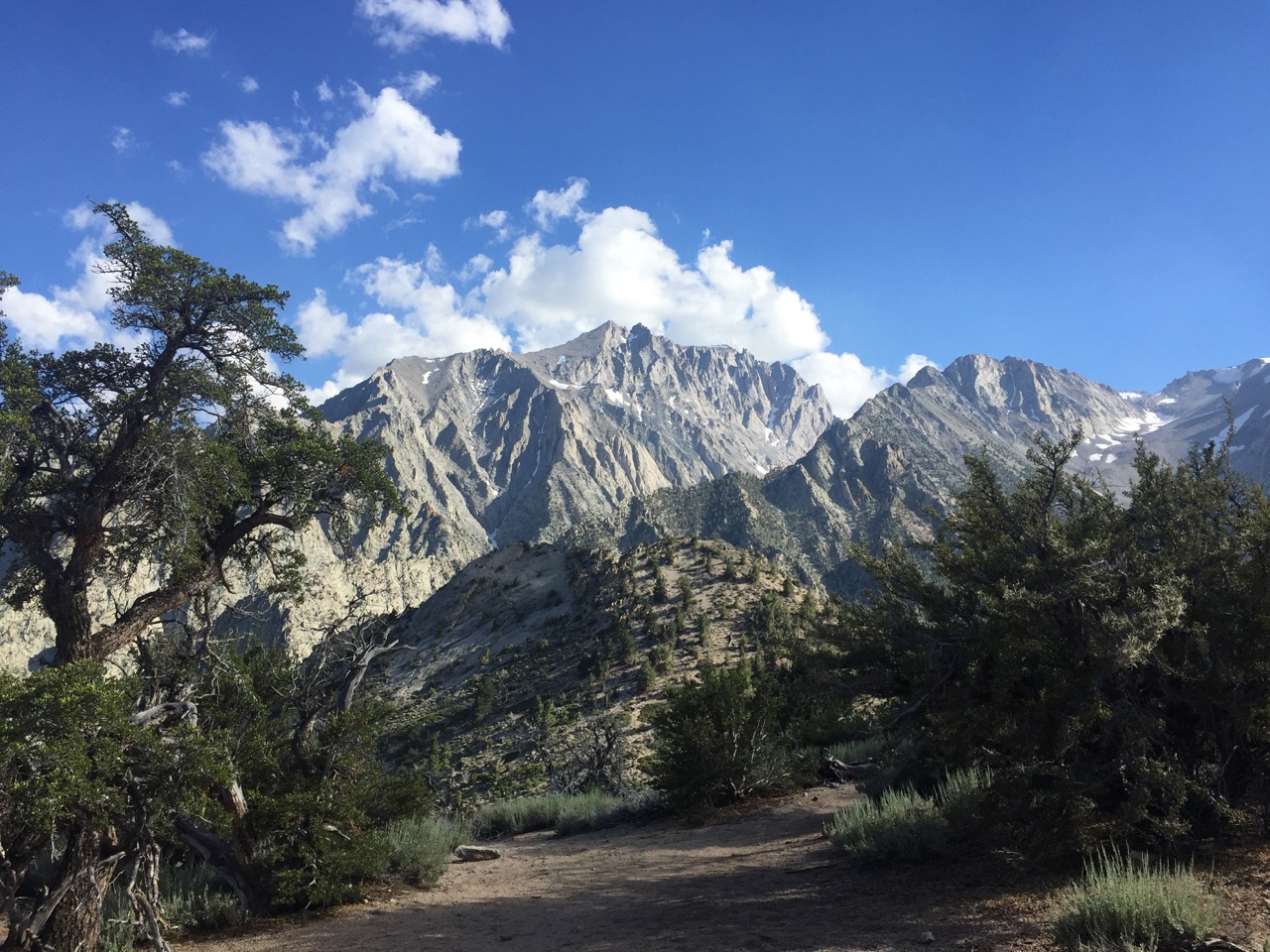
After about a mile I started to get my answer. Staring up a mountainside of switchbacks, it became a one-foot-in-front-of-the-other sort of affair. After 45 minutes, one soaked shirt, and again realizing that, despite my hopes, my legs are not in the shape they were a year ago on the PCT, the switchbacks topped out 1800’ higher than they started.
This gave me the first glimpse of Mount Williamson from the trail. My first thought? “That seems impossible”. Then I remembered how, by taking things one step at a time and slowly chipping away, you can do incredible things. Like walking from Mexico to Canada. I think that is a good approach to life as well - set clear goal, and make consistent progress towards those goals. Setting the clear goal seems to be the hard part, and fortunately my goal was already set. So I kept hiking, getting closer to the summit one step at a time.
One step at a time!
A nice, easy pace for another couple of hours, over some moderate terrain, landed me at my campsite for the evening - a patch of semi-rocky ground overlooking the Owens Valley, with a (cold) mountain stream gurgling nearby. Much better than car doors slamming and airplane flying overhead.
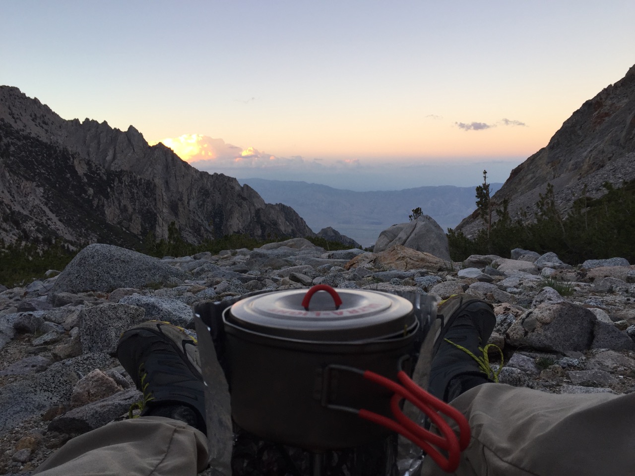
Dinner and a view
After 120 days of instant mashed potatoes and off-the-shelf dehydrated meals on the PCT, I decided to experiment with different foods on these shorter trips. Dinner was going to be a Pad-Thai-esque dish with edamame noodles, freeze-dried veggies and some spices, topped with peanut butter. As I was sitting there mindlessly kneading the peanut butter packet, about ready to tear it open, I happened to glance at the label and was forced to do a double take. Yup. ”25mg of caffeine per serving". Are you kidding me? Who adds CAFFEINE to PEANUT BUTTER? As someone who drinks coffee only when I need a kick (which a cup of joe definitely provides), this innocent looking packet would probably keep me up all night. At least it will come in handy in the morning…
Day 2
- "It's not that bad!"
- Solitude
- Tagging
After overcooking my breakfast to the point where it charred the bottom of the pan (and then scrubbing furiously to try and un-char it) I threw what I needed for the day in my pack, and started walking. I'll be back to this campsite tonight, so the tent, sleeping bag, and other unnecessary paraphernalia stays. Hooray for a lighter pack!
Shepherd Pass was the first hurdle of the day. When I caught my first glimpse of it yesterday, I thought “Shit, I might not make it over that". It looked steeeeep, and snow-covered. An up-close view assuaged my worries, and after chaining up (putting my crampons on) and tethering myself to my ice axe, I was up and over the 45(?)-degree snow bank in no time.
Then I got hit square in the feels. After topping out, the trail offered panoramic views of Sequoia National Park. My favorite day on the PCT was the day I climbed over Forrester Pass, now just to my north. From my current vantage point I could retrace much of my path from that day, and again saw the heart of the Sierra that touched me so deeply last year. I caught my eyes getting a little damp.

Sequoia National Park, and the heart of the Sierra

The Williamson Bowl (the west face of Williamson is on the left)
If I would have known what was in store for me today, I probably would have teared up for a different reason. It was time to leave the trail, for a cross-country route-finding scramble to the top of the second highest mountain in California. The first order of business was crossing the Williamson Bowl, a glacially carved bowl that doesn't have anything representing a trail going through it, and is strewn with everything from rocks the size of a golf ball to boulders the size of a car. So I 'boulder hopped' my way across, broken up by the occasional snow field.
Ankles intact, I approached Williamson's west face, asking myself "where is this route supposed to go?!?". Turns out the answer was "2000 feet straight up this chute in the side of the mountain". "Straight up" might be a bit of an exaggeration, but I would put the grade over 50 degrees, with some class 2/3 climbing to get around otherwise impassable snow fields. It's not that often I get gassed when hiking, but this did it. Eventually I fell into a rhythm: climb for 30 breaths, rest for 10, climb for 30, rest for 10. Repeat.

Are we there yet?

It's not as bad as this makes it look. I promise, Mom
Finally, I made it to the hardest part - The Chimney. It's a class 3 climb of about 100 vertical feet. This is where I had to check my ego - a fall on this exposed section would be hazardous, so if it got too sketchy I was turning around.
The climbing turning out to be within my skill and comfort level, and I popped out of the Chimney (I think there could be a Santa joke somewhere there...) with only another ten minutes of boulder hopping to the summit.
The times I have climbed Mount Whitney, the trail has always seemed like a highway going up, with a small city of hikers on the summit. Not so on Williamson. Though I could see Whitney to the south, I was the only one on this mountain, and the first person to have summited in nine days. Lunch, mediation, and some reading filled up my two hours spent on the summit. I need to get better at describing this feeling with words.

Sequoia and Kings Canyon to the west

Mount Whitney to the south

And another shot thrown in for good measure
Then the clouds started getting a little dark, so I decided it was time to head down. The descent wasn't as physically demanding, but was more mentally draining, as a false step at the wrong time could put you in a bad spot. To reward my focus, and the accomplishment of getting up AND down that mass of granite in one piece, I decided to tag one of the lakes in the Williamson Bowl. Not familiar with tagging? Here's a PG-rated watch:
It's obvious that I was never on the diving team.
Refreshed, to say the least, it was an easy downhill jaunt back to camp, with plenty of daylight. I was surprised to go the entire day without seeming anyone, especially when they issue at least a dozen permits per day for this trailhead. I'm hoping a zombie apocalypse didn't break out in the last couple days...
Day 3
- Familiar faces
Despite waking up at 5am this morning, I still got over nine hours of sleep. I’ll let you do the math, but suffice to say that was the earliest I had fallen asleep in quite some time.
After an (un-charred) breakfast, some stretching, and an hour of reading, it was time to break camp and head down the hill. After about half a mile I ran into the first people I had seen in nearly two days. Most surprising was that I recognized one of the faces! Steph, one of my CrossFit friends from LA, and a fan of climbing tall mountains, was on her way up with a group. I’m not sure what the odds of that are, but it seems I have my Dad’s knack of running into people he knows in the most unexpected places.
She's clearly terrified of my impressive hunting abilities...
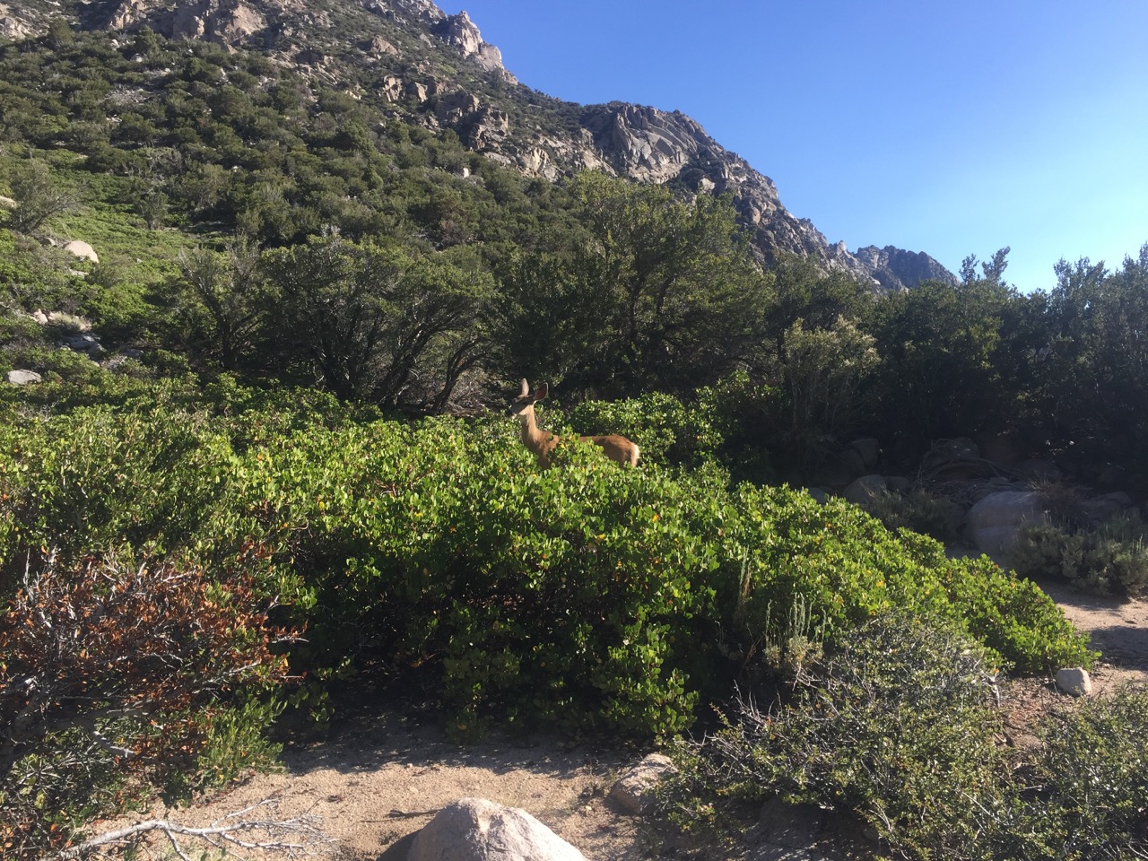
Another six hikers, a deer, and several miles later, it was back to the car. It felt great to slip into shorts and sandals, though my feet had started giving off a rather offensive odor. As I drove off (with the windows down), I caught myself spending more time looking over my shoulder at the mountain than was probably safe. This ended up being another great trip into a beautiful mountain range - one that I hope holds many more such experiences.

Until next time...