
Day 44: mile 942.5 - 971.5
- Bridges? Please?
- Benson Pass
- "You can send your ice axe home"
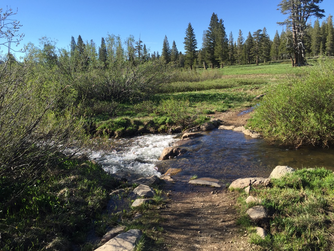
After sleeping through my alarm (as can be expected when sleeping with earplugs in) I got back on the trail around 6:30. The first few miles were very touristy (wide trails, informational signs telling you about the wilderness/wildlife, deer that let you walk within ten yards of them, etc.), but things started returning to normal after that. The first creek/river crossing had a bridge. As did the second. But not the third. Or the fourth. Or the fifth... Looks like it's back to fording. Hello again, wet feet!

Leaving Tuolumne

Taken from the last bridge that we got

No bridges anymore...
The first twenty miles of the day seemed to go by quickly. Not a ton of wet trail or snow cover, despite a good bit of up and down. In looking at the elevation gain/loss for this section, it has about as much gain/loss per mile as the JMT. So even though it doesn't have these intimidating passes, there is still a lot of up and down. I guess that is what happens when you hike through mountains?

"I guess this rock looks like a good place to grow"

Meadows (complete with a few bugs)
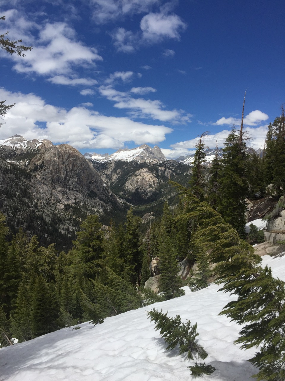
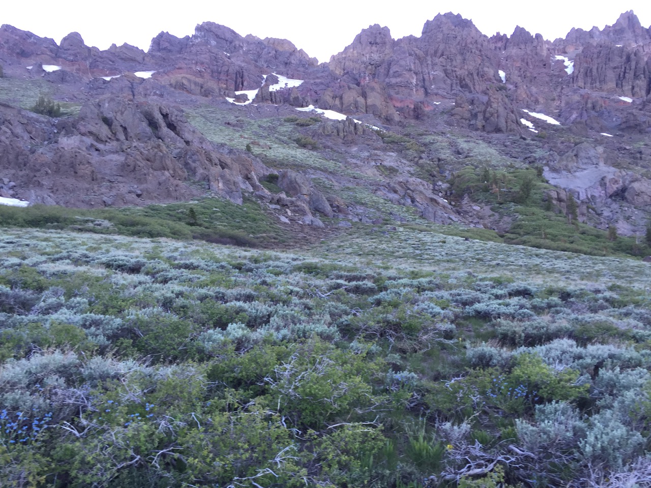
I was feeling good enough in the early afternoon that I decided to tackle Benson Pass. While "only" 10,100' (nothing compared to the passes from the previous week) it was still covered with snow, and the last mile was sloooooow going, as there weren't many pairs of footprints to follow. I'm looking forward to the day when it's impossible to lose the trail. This snow-covered shit is starting to get old. But, I signed up for it by entering the Sierras early, so onward we go!
Here we go again!
Near Benson Pass
A few miles off Benson there was another, lower, "pass" the trail took us over. It didn't have a name, but coming down its shaded north side was hairy. Like, I'm-glad-I-have-my-ice-axe-and-know-how-to-use-it hairy. That mile was way more intense than any of the other passes I have come down. I hope the hiker at Tuolumne Meadows who was trying to convince everyone to send their spikes and ice axes home got some sense talked into him...
A few more miles and it was time to set camp. I'm by myself for the first time in a while tonight. I had two friendly visitors (deer) while I was setting up my tent. We'll see if the night brings more...
Day 45: mile 971.5 - 997.8
- The hardest ford
- Adios, Yosemite
- Sleeping high (in elevation)
I didn't want anything to do with my alarm this morning. A peek outside my tent showed a gray sky. Ugh, more wet.

How is this day going to turn out?
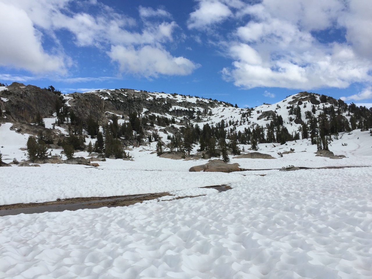
I was right on the wet account, it just didn't come from the clouds today. They burnt off early in the morning and made for a beautiful blue sky later in the day. But the trail was a mess. At the lower elevations it was a puddle or a stream, and at the higher elevations a slushy snow field. I didn't even try to keep the feet dry today. There is something so liberating about just splashing across a creek with no regard for staying dry.
They couldn't have put the trail on the other (dry) side of the creek?
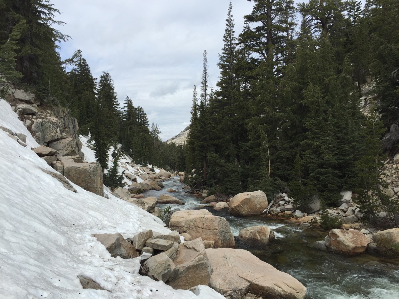
A few of the "creeks" demanded a bit more attention. Late morning I hit the one that is generally considered the toughest ford on the PCT. I'm glad I didn't hit it much later in the day, because the water still came up to my waist. And not just lazily-flowing water. This water meant business. After several tense seconds where I'm sure I forgot to breathe, the worst was over, and I waded the rest of the way across. Then it was time to watch the hikers behind me give it a go. So much for those bridges...

Pictures didn't really do this one justice...
After a slow morning due to snow, the afternoon picked up. The entire day was spent below the tree line, and with trees obscuring the view, it's hard to get a picture-perfect shot of the mountains. But even though you can't see them all at once, you can feel their towering presence.

Occasionally you can climb up on the rocks and get a view

And you get some lakes
A mile or so before pitching my tent and calling it a day, the trail left Yosemite National Park. The snow was deep enough to bury the sign, so I'll have to take my paper maps' word for it. Yosemite is definitely better on the less-traveled trails.

And you get some reflective lakes
I camped just on the north side of a pass, in one of the few sheltered, dry spots among a snow field. The wind is blowing again, but I picked a much better place to pitch my tent. Or at least, that little voice in my head is content. This will be the first real test of my tent pole patch-job. Earplugs in...

The view from tonight's home
Day 46: mile 997.8 - 1023.2
- The Pacific Crest
- A Fathers Day Surprise
I can't figure out how to get my watch alarm to go off on the weekends. I must slowly be losing the ability to interact with technology. Either that or I'm really good at sleeping through my alarm. Either way, I woke up with my tent in one piece, and I was back on the icy trail by 6am.
By 7am I had hit a pretty cool milestone - my thousandth mile (I never realized how literal these "mile stones" are). Never mind how many more miles we have left. 92 miles to South Lake Tahoe. That's all that matters right now.

Four digits!

Diggin' the greenery
The trail was easy the rest of the morning, and then it started to climb. And climb. And climb. It was back to some massive snowfields again, and again the slow going was worth it. Although this is called the Pacific Crest Trail, thus far it hasn't seemed very crest-y. The desert was pretty flat, and even the Sierras (with a lot of ups and downs) was mainly walking over passes and then down valleys until the climb to the next pass. So there were only a few places where you had really panoramic views.

Time to put the chains back on...

Another look south. The last time I'll be seeing some of those peaks for a while...
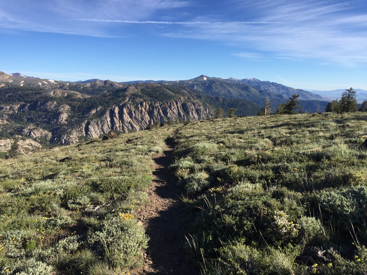
But today the trail took rewarded us with about six miles of an epic ridge walk. The scene that was playing in my head was like something from Lord of the Rings, where Aragorn or Gandalf is riding their horse along the top of a mountain range, with clear skies, snow-capped mountains in the distance, and epic music playing in the background. I'm sure I didn't look that cool, but it felt awesome.

We are about to go right down the top of that

Like a good kid I made a detour to the top of a high point (where I had cell service for like the second time in 200 miles) and called my dad to wish him a happy Fathers Day. Little did I know that he, my mom, and my sister had taken a road trip to Sonora Pass, and were waiting for me about five miles down the trail.
I only hiked about four of those miles, because there was some pretty awesome glissading that bypassed a lot of trail. So I got my glissading on. Much to the chagrin of my pants. I have now given up on trying to keep them presentable. My ass is going to be hanging out until South Lake Tahoe, at which point I'll break down and buy a new pair.
I met the family a little ways up the trail. Apparently I smell a little bit? I didn't think so, but Dad and Darby were quick to point it out. Mom was a little nicer about it. A fresh salad, grilled chicken, elk burgers, and fresh cherries later, I was recharged and ready to take on the next section. Between me, Cashmere, and another hiker who passed through, we emptied the cooler that my parents brought. But it was great to see everyone, and easy to get back on the trail knowing that I'll be home for a few days once I get to South Lake Tahoe.

This is Darby's "Why do I have to be related to you?" face
It was back on the trail for one more pass and snow-filled descent. I don't want to get too excited, but the next section doesn't have much trail over 9,000', meaning I think we'll be below the snow line. As beautiful as the snow has been, I'm ready to not have to use a map and compass to navigate. I have been saying "we are almost out of the snow" since Tuolumne. At some point I'll be right.

Looking back towards Sonora Pass

Purple on white
Day 47: mile 1023.2 - 1053.2
- The fine print
- New "sunglasses"
- Going the extra mile
Getting up was easy this morning, and it was the earliest I had been on the trail in a while. My feet were quickly wet, as two stream crossings started the day off. Once I got another mile down the trail I realized I had lost my sunglasses. They must have come off my hat as I was executing one of my graceful stream crossing maneuvers (i.e. uncoordinated lunge).
I backtracked about a quarter-mile to try and find them, but with most of the snow behind us, I decided I could make do without. I'm glad I didn't lose them in the Sierras - that could have been dangerous. I'm also apparently good at losing sunglasses. I think I'll stick with the five-dollar varieties when I get my replacements. Maybe they'll be pink to match my phone case...
There should be deer in here somewhere
Every evening I look at my topo maps for the next day's trail, to get a sense for what is in store. Last night I checked out the maps, and it seemed like a pretty mellow day. A few moderate climbs (nothing longer than a mile or so) and a few equally long/short descents. "Sweet, easy day" I thought. A few hours in and I made it to the top of the first climb, sweating and breathing A LOT harder than I was expecting. I double checked my map in disbelief - the section I had just climbed was pretty damn steep. Sure enough, the map makers had played a trick on me and changed the contour interval to double what it was during the Sierras. So all that "mellow looking" terrain on the topo map was actually steeper than I thought. Always read the fine print. Or the instructions.

Can still see Sonora to the south

Little flowers...

... and bigger flowers
The day was, for the most part, spent on clear trail going over green ridges and through wooded draws. We had a good number of snow field crossings as well, though nothing compared to the previous weeks. After the first one I was really wishing I had my sunglasses. After the second I had to sit down and let my eyes rest. Coming up on the third I tried putting my bug net over my head to see if that helped. Viola! Instant sunglasses. So between my bug-net-sunglasses and my massively ripped pants, I was quite a fashion statement on those slopes 😎

I keep telling myself we are almost out of the snow

You can make out the Carson Valley, and the side of Mt. Rose, wayyyy up north. I can almost see my house from here!
As the day wore to an end I knew I was coming up on thirty miles. So I intentionally walked juuuuust far enough to give me thirty for the day, and threw up my tent. Two other tents were nearby, and they had a campfire going. Feeling more social than usual I went over and introduced myself, and proceeded to learn all about Irish and Sweet P. It ended up being a fun evening, though now getting up in the morning is going to be tough. And my sleeping clothes/bag smell like smoke. At least that is better than whatever I smelled like before...

Afternoon shadows
Evening scenery
Day 48: mile 1053.2 - 1081.9
- Sage hillsides
- Snow is melting fast...
- ...but not fast enough
- Carson Pass Station
I was the first one up and out of camp. I was tired from the short night of sleep, but I can't bring myself to lay in my tent when it is getting light outside. Pretty sure archery hunting conditioned that. The sun was starting to kiss the mountains as I got on the trail around 5:30.

5:30am, just outside the front door
The morning scenery reminded me a lot of some of my favorite places in Nevada. Huge sage hillsides, with occasional patches of timber, and water flowing down every ravine (the latter of which is less common in NV). Walking through that made the miles fly.
Gotta love them sage ridges


Until I ran back into snow. I put my chains on once, and broke the ice axe out three or four times to cross some steep slopes. The snow is getting better (on hot days like this, every drift has a stream of water running from it) but is still several feet deep in places. I only needed to break out the GPS for a quarter mile, so things are looking up!

Only a few big snow patches left!

I later learned from the rangers that this is Hope Valley
Twenty miles in I came to Carson Pass, along Highway 88. The Carson Pass Station (a little store/ranger station) was open, and had two very friendly volunteers out front. They immediately pegged me as a PCT hiker (not sure if it was the sun bleached cheeks, the patchy facial hair, the dirty attire, or the stench, but something tipped them off) and offered water and a cooler full of food. It was probably because I told them I was born and raised in Reno, but the two locals were super friendly, and it was great to sit in the shade, shoot the shit, and snack on baby carrots and hummus. Mmmmm...
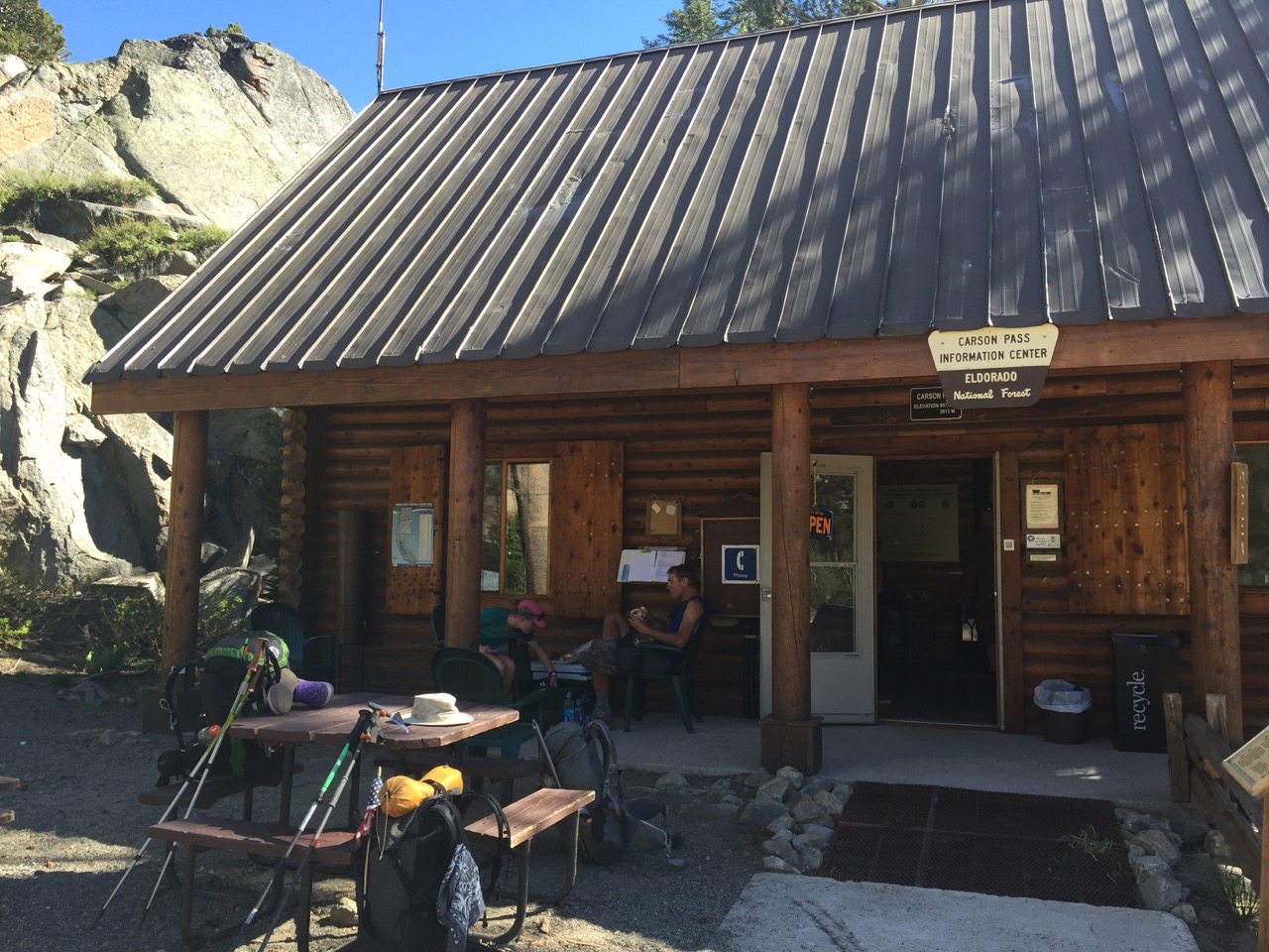
Carson Pass Information Station
While there I signed the trail register. Curious, I checked how many people were in front of me. I was number 53. I'm sure not everyone signs the register, so there are more ahead of me than that, but regardless, I have finally gotten ahead of "the herd". Maybe that's why the folks at Carson Pass Station were so friendly: I was only the 7th hiker they had seen that day. There were more than fifty of us at Hiker Heaven (mile 454.4) when I stayed there. Part of the reason I have been putting in bigger miles is to get ahead of The Herd. Now I can slow down a bit. Maybe 😉
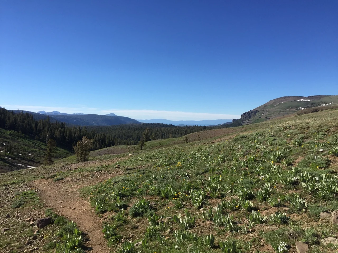
It was five more miles to camp. Along the way I caught my first view of Lake Tahoe from the trail, joined up with the Tahoe Rim Trail, and forded the Truckee River (okay, it was the headwaters of the upper Truckee River. Nothing too impressive). It's good to be closer to my home turf. Especially when I have my own bed to look forward to tomorrow night 😴😴😴

Pretty views just a few miles from Carson Pass
The first glimpse of Lake Tahoe (wayyyy out there)
The headwaters of the upper Truckee
Day 49: mile 1081.9 - 1092.2
- home
The last several days have really worn me out, which made getting out of bed reallllly tough. The one thing I had going for me was that my sister was picking me up at Echo Lake around 10am. So I only had ten-ish miles. My feet could handle that.

Breakfast view
It felt like forever, but I finally made it to Echo Lake, where Darby soon came rolling up. She was polite enough to not tell me that I reeked, and instead subtly suggested I roll the car windows down. Another hour and I was home! It was time for a shower (my eighth shower in 49 days), laundry, and family.

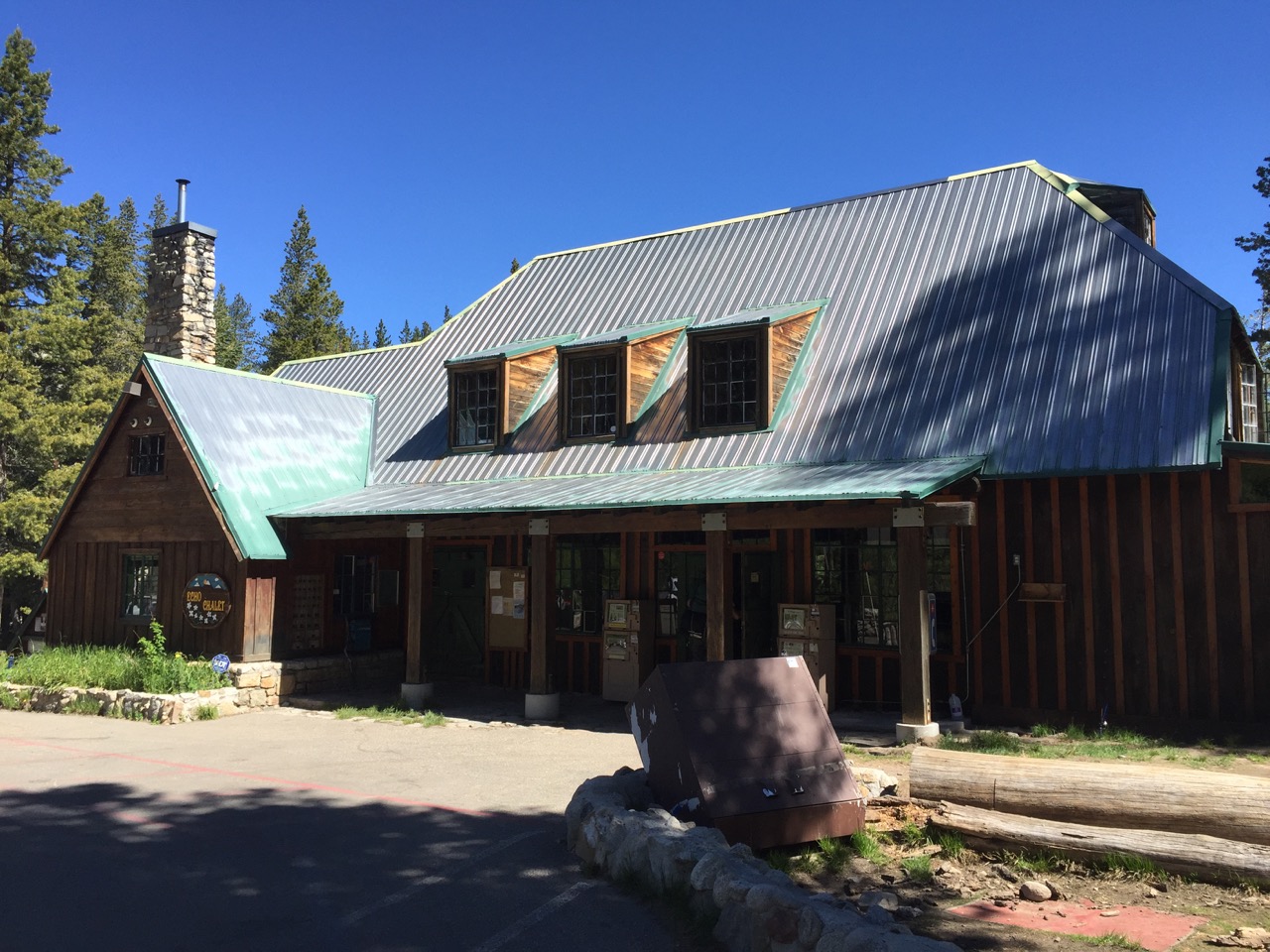
Echo Lake Chalet
I'm planning to climb Mt. Whitney with some LA friends on Friday and Saturday, but aside from that I'll be in Reno spending time with family, stuffing the rest of my resupply packages for the remainder of the trip, and getting some new pants. And eating obscene amounts of food. Life is good.

Are they really that bad?
Day 50 - Day 54
- Getting weird looks at the supermarket
- Mt. Whitney was even better the second time
- Resupply packages stuffed
- Ready to rock! Errr, walk
Thursday consisted of purchasing the dehydrated meals, chocolate, mashed potatoes, granola, and chocolate that will get me through the rest of the trip. Checking out of REI with 40 dehydrated meals and then WinCo with ALL of their dark chocolate bars garnered a few looks from inquisitive folks wondering what the hell I'm doing. Sometimes I wonder that as well. Some time with the family (sharing trail stories/gossip, answering questions, eating, and getting my third pair of sunglasses so far) rounded out the day.
Friday involved a drive to Lone Pine, and the first six-mile leg of the Whitney climb. I lucked out, as Highway 395 was closed near Lee Vining about 15 minutes after I passed through due to a wildfire. I'm surprised it wasn't already closed, because the flames were already up against the road. Fire season appears to be in full swing.

I think the highway goes right by that...
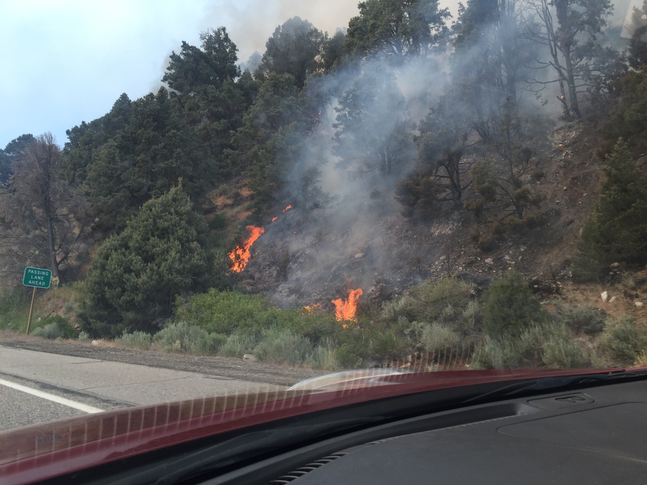
I wasn't driving and taking pictures at the same time...
I was anxious to see how this Whitney trip would go. It was one of those deals where no single person knows everyone in the group, so you aren't quite sure how everyone will gel.
Fortunately, it was a fucking blast. We made it to the summit (despite the elevation and patches of ice high on the mountain), didn't get attacked by any bears (despite some snoring and midnight sounds that may or may not have been mistaken for bears), and didn't starve (despite someone forgetting the burrito-in-a-bowl dehydrated meals they were planning for dinner, but remembering to pack perfume... I won't say who did that, I'll just say I don't wear perfume. That narrows the options down to three). A few of us even got to sneak in a side trip up Mt. Muir (another 14,000'+ peak requiring some class 3 climbing), and I got to test out my new pants with a 1000+ foot glissade down some of the snow-filled chutes. I had a coldddddd ass, but they held up just fine!

Sunset from camp

Reflections to the west

Mt. Muir (the big one in the middle)

Started from the bottom now we here...

... and now we are back to the bottom! Happy (if not tired and sore) hikers!
I had such a good time that after we got back to the cars and said our goodbyes, I was legitimately bummed out as I started my drive home. Being on the trail for the last fifty-plus days has made me realize how much I value relationships and time spent with great people. And this was a group of awesome people.
Then it was back home for a short night of sleep and a Sunday spent stuffing boxes. It took three of us the better part of a day, but my resupply boxes for the remainder of the trip are now complete, sans a few last-minute additions that my mom will add just before the packages are sent. Canada, here we come.

Resupply boxes? Check. Dorky little sister? Double check.
Monday was spent lounging around, and getting the last few "to-do" items checked off my list. It will be back on the trail (via my little sister's generous shuttling service) tomorrow morning. The break has been nice, but I'm ready to get back on the trail with some more time to myself. And I'm ready to keep chipping away at these miles. One step at a time.