
Day 76: mile 1597.2 - 1623.0
- Escaping the vortex
- Marble Mountains/Wilderness
It's too bad mattresses weigh so much, because they are soooo comfortable to sleep on. Clean body, clean sheets, and a comfy mattress made for a good night of sleep. And a serious morning deliberation of whether or not I wanted to stay another day. I decided to punt the decision until after breakfast, so I biked to the restaurant and had a great meal of eggs, hashbrowns, pancakes, and bacon. In hindsight, that probably wasn't the best way to convince myself to leave town. But I somehow decided to get back on the trail.

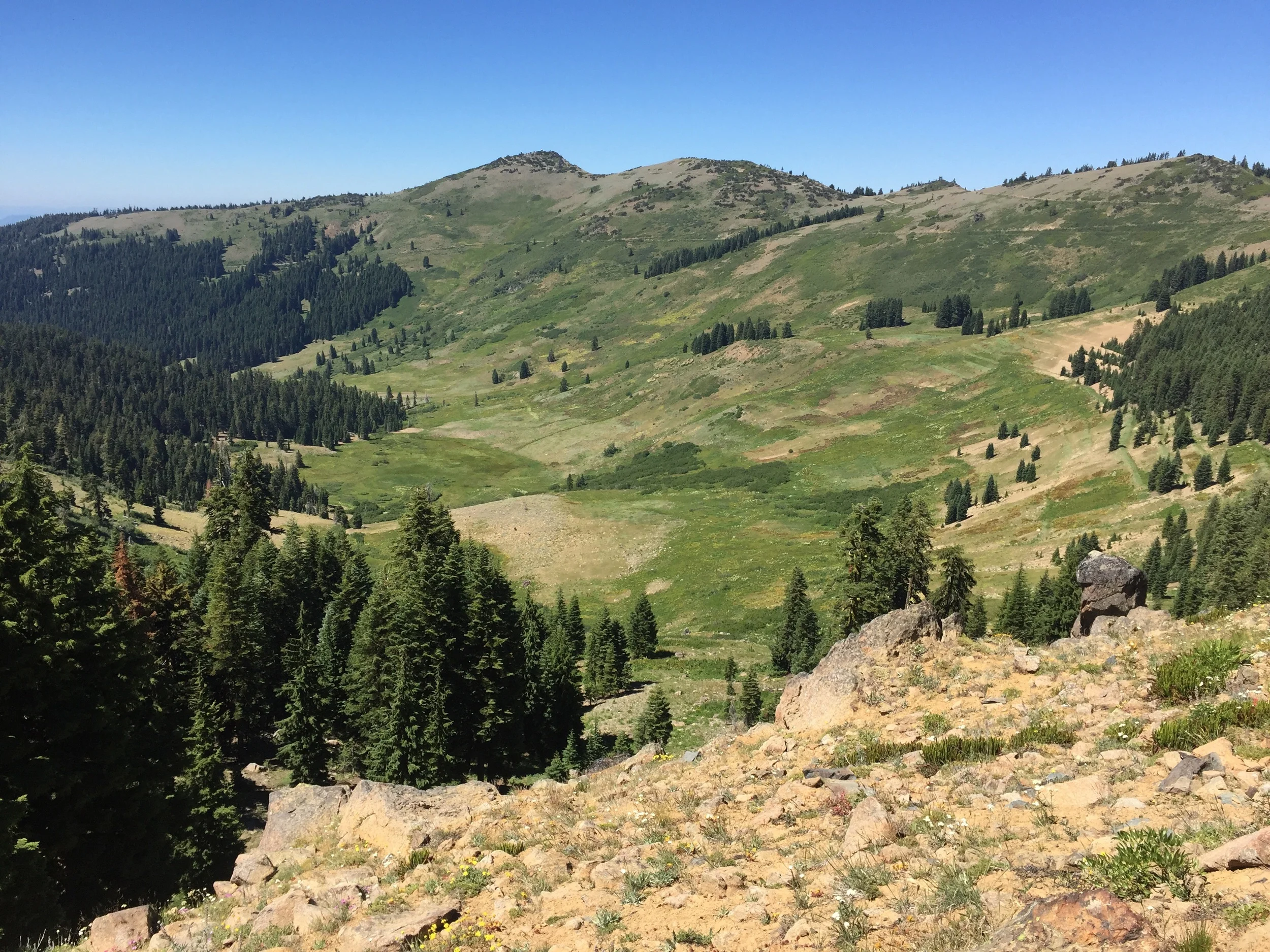
The Marble Mountains
I was walking by 9:30, and quickly entered the Marble Wilderness. Day and section hikers heading southbound have been telling me for about a hundred miles that The Marbles are some of the prettiest mountains in Northern California. While there haven't been the epic vantage points that capture the mountains in totality, they certainly are beautiful. The last of the snow fields are just melting on the highest north-facing peaks, and all the vegetation is a verdant green. A splattering of alpine lakes, rocky, treeless peaks, and an abundance of wildlife, complete the scenery. (Note to future self: Marble Rim looks like it would be a cool weekend trail)

Snowy mountains to the south
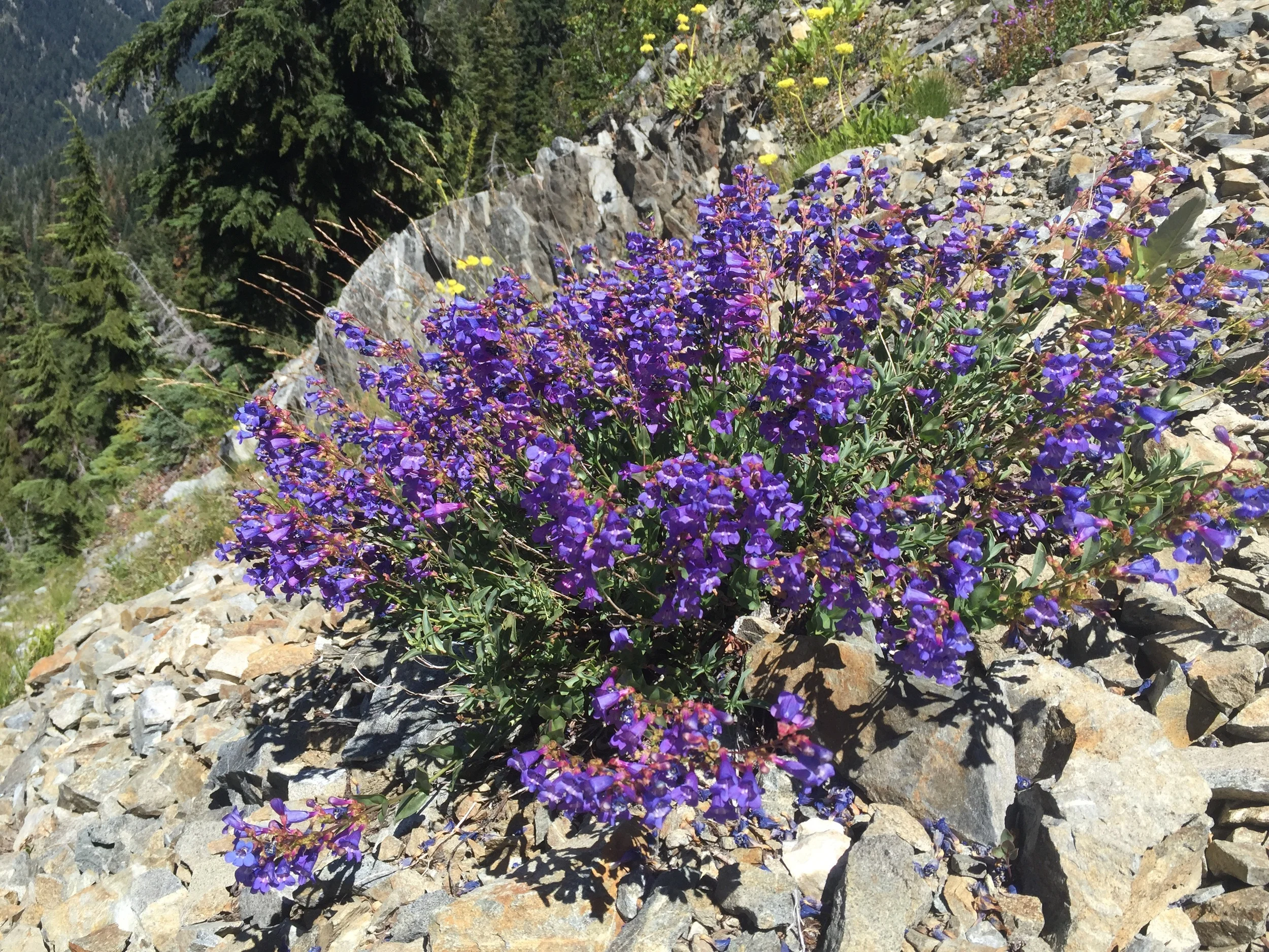
Spicing up the rocks with some color
And I keep telling myself we have seen the last of Mt. Shasta. But every time the trail hits a high point, there she is, still towering in the distance. So I'm still getting my daily quota of Shasta pics. I'm pretty sure you can't see her from Canada, so they'll have to stop at some point...

More Shasta 😍
Tonight's campsite is one of the better ones I have had on the trail. Secluded, with great views of the mountains and skies to the east (read: sunsets), and cool enough to keep the bugs at bay. This will be another night where my nose gets cold. But those are the best nights 😌

I wish I didn't have to stay up so late to catch these sunsets. #hikerproblems

The trail goes over that?!?

The deer weren't too concerned with me...
Day 77: mile 1623.0 - 1653.4
- Wildlife
- Wild berries
- Seiad Valley
It was another eventful night, as I was woken up by inquisitive deer on more than one occasion. It is still a full moon, making it pretty easy to identify the sources of the footsteps. A little buck was my first visitor, and then a group of does about two hours later. Even the earplugs didn't keep their snorts from waking me up. But it feels cool to be surrounded by wildlife (as long as it doesn't want to eat you...)
When I finally did get to sleep, I slept hard. My beanie was pulled over my eyes to block the moonlight, and it worked like a charm. Unfortunately it also blocked the sunlight, and I didn't wake up until well after the sun had hit my tent. Nice.

The view from my tent once I (finally) got going

Black Marble Mountain
The first ten miles were beautiful. We were high up in the Marble Mountains, where everything was still cool and green. And deer running EVERYWHERE! I even saw some elk tracks in the trail, but didn't see any more evidence of the beasts.

Looking back towards the heart of The Marbles
Then the trail started a loooooong descent into Seiad Valley, a small town along the Klamath River. We dropped down to around 2,000' while hiking through a two-year old burn area, meaning it was very exposed. Even though we were going down, it was HOT. That, coupled with my feet, which were really starting to hurt, made for a long descent.
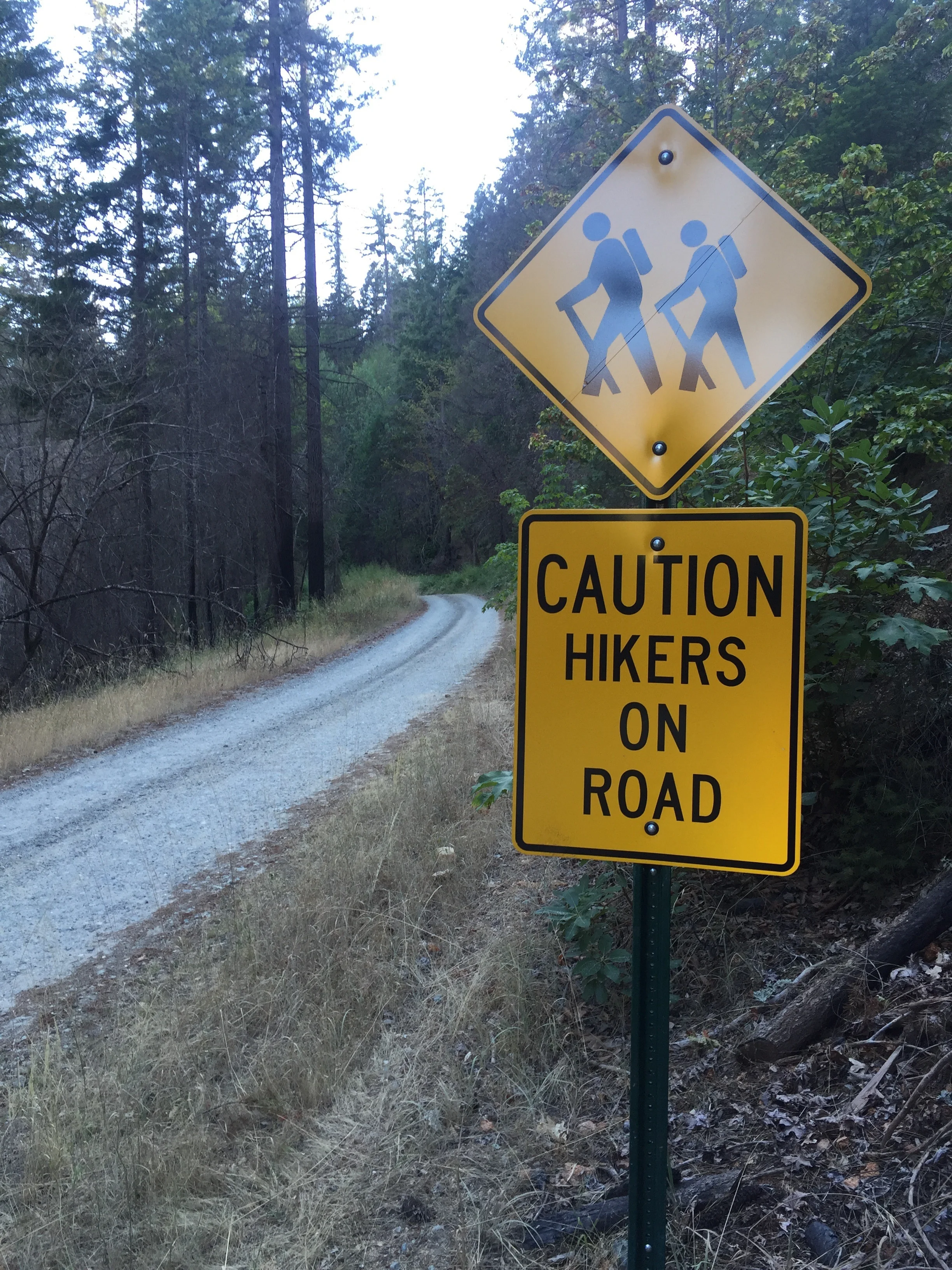
The last 6.4 miles into Seiad are a road walk. I told myself that I wouldn't hitch, but if someone stopped and offered me a ride, I would take it. Every step was painful at this point.
Damn hikers...
It's a good thing someone stopped and asked me if I wanted a ride after 2.5 miles, because that walk would have taken forever. I was getting slowed down by my feet (which didn't appreciate the asphalt), but more effective at slowing me were the wild blackberry bushes that were lining the road. I could make it about a hundred yards before stopping to pick another handful of blackberries. If I hadn't have been picked up, I might have eaten myself sick...
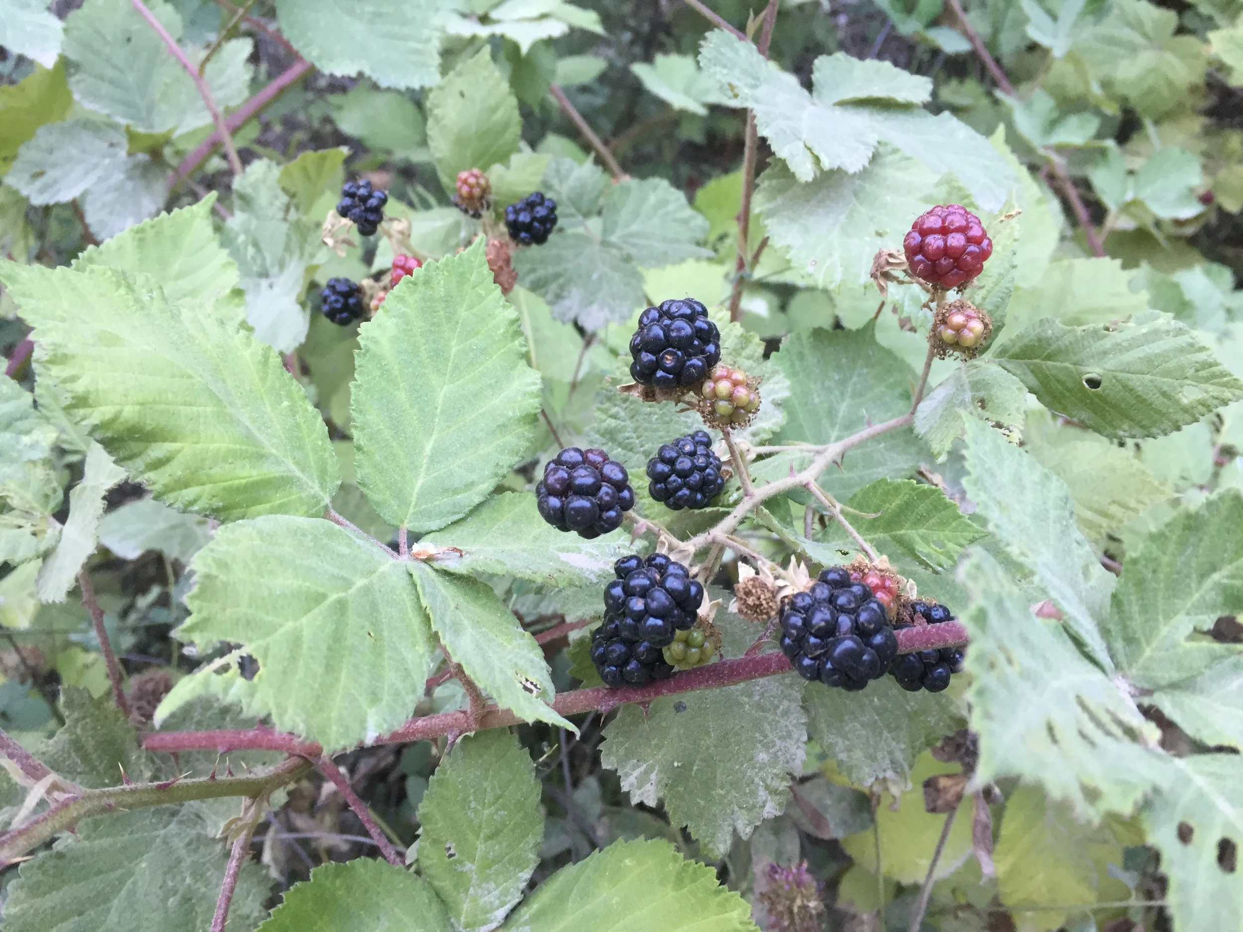
These...

...make for a purpler-than-usual tongue
The Seiad Valley RV Park is very hiker friendly. I rolled in, paid my $15, which got me a shower, load of laundry, and spot to pitch my tent on the cool, shaded, grassy area of the RV Park (with some other hikers). The shower (and clean clothes) were great, but I was limping everywhere on some miserably sore feet. We'll see how they are in the morning.
Day 78
- Finally listened to that little voice
I got up to use the bathroom in the morning, and it felt like a Herculean effort to hobble the hundred feet to the restroom. I'm not sure the bottoms of my feet have ever hurt this bad. Couple that with a tight left achilles, and it didn't look like I was going anywhere today. I went back and forth with myself for about an hour, deciding first to push through the 63 miles to Ashland (where I was planning to meet my parents in two and a half days), then deciding to stay in Seiad Valley for a few days, then deciding to go to Ashland, then deciding to stay in Seiad...
Ultimately I decided to stay in Seiad, and instead meet my parents here (with a new pair/model of shoes). It's no fun hiking when every step hurts, and if I push through I could injure myself worse. At least, that is what the little voice in my head is saying. So I'll be spending the next two days and nights in Seiad Valley, population 300, with one cafe, one grocery store, and an RV Park. At least it should be pretty easy to stay out of trouble...

Downtown Seiad Valley
Day 79
- Pancake challenge?
- State of Jefferson
Fortunately the little cafe here has some great food, and amazing milkshakes. They also have a pancake challenge that is well-known among PCT hikers. I didn't see anyone attempt it this morning. And I can't blame them. You have two hours to eat five one-pound pancakes. Do you know what a one-pound pancake looks like?!? It covers a full plate, and is like an inch thick. I briefly considered it (not like I'm leaving anytime soon) but then imagined five pounds of pancake batter in my stomach... Ugh. I know my digestive system thanks me.
Seiad is an interesting place. There are "State of Jefferson" and "No Monument" stickers, posters, t-shirts, etc. all over the place. I'm not qualified to give a history lesson on the topics, but Wikipedia/Google do a pretty good job. While the people here might have very different political preferences than most thru-hikers, they are all super friendly, and very accommodating. I imagine we provide quite a bit of business for this small town.
As neat as this place is, I'll be getting out tomorrow (Saturday). My rockstar parents will be driving out here, and we'll either head north to Ashland, or hang out around Mt. Shasta. They are also bringing a new pair (and new model!!) of shoes with a lot more support and padding. So I'm going to try those bad boys on and hopefully give them a trial (or trail?) run on this next section!
Day 80
- Fresh shoes
- Yreka (pronounced why-ree-ka)
After one more breakfast at the cafe, my parents rolled in later in the morning. The shoes (the HOKA Challenger ATR's) felt great on my feet, a promising sign. We decided to head about an hour east to the town of Yreka, and spend the day exploring, before coming back to Seiad Valley tomorrow and dropping me off at the trailhead.
Yreka ended up being a neat little town. It was actually the proposed capital of the above-mentioned State of Jefferson, and had some unique history. We checked out the local museum, and then took a walking tour through several neighborhoods whose houses has been built in the 1850s and 1860s, when the town was starting to boom. A lot of history for a little town of 7,000 in the middle of nowhere in California. All tourist-ed out, we retired to our hotel room for some card games and conversation. Not a bad way to spend the day.
Day 81: mile 1653.4 - 1673.0
- The Climb
- Happy feet
I'm probably going to have a hell of a time getting up tomorrow morning. The more time I take off the trail, the later I wake up. Once I finally woke up this morning (with my parents patiently waiting for me) it was off to a hot breakfast, and then a few more games of cards (Pinochle was the game of choice). After Mom severely kicked our asses (twice...) the guys had enough, and we packed up and made the curvy hour-long drive back to Seiad. A garden-fresh salad at the trailhead, and a few hugs and goodbyes, and it was time to start walking.

Looking back over Seiad Valley
The climb out of Seiad Valley is steep. Almost 5,000' elevation gain in 8 miles, starting at 1,300'. It is also exposed. Smart people usually don't do it in the middle of the day when temperatures in the valley are in the nineties. But I didn't want to sit around anymore, and I'm not sure how smart I have been out here, so I put my head down and started climbing.
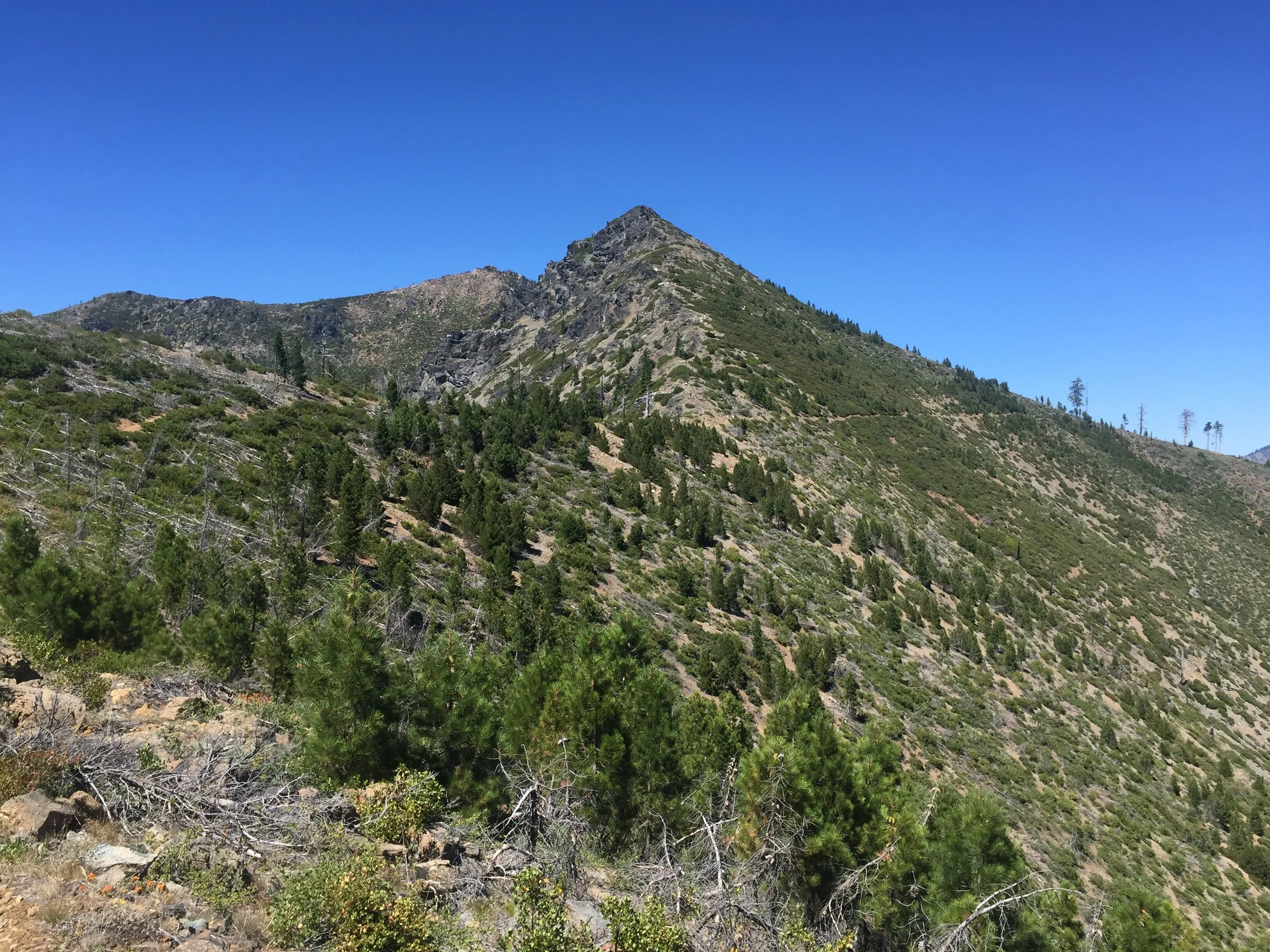
Made it to the top, but still exposed
To my surprise, I wasn't the only one climbing it in the middle of the day. Even though we all knew it wasn't the best idea, we all enjoyed bitching to each other about the heat. That must have made it go faster, because I was at the top before I knew it. My clothes that were clean this morning had some nice sweat/salt stains. I'll be smelling that for the next few days...

Daily Shasta quota
It was another ten easy miles before setting camp at a later-than-usual time. That meant I got to see the purple and orange evening colors as the sun set. I have always said that my favorite color is green, but after the sunsets I have seen on the trip I'm leaning more towards a deep orange. Funny how things change.

Crawling into bed my feet (complete with new shoes) were feeling good! Fingers crossed that they continue to feel good as I ramp up the miles over the coming days.
Day 82: mile 1673.0 - 1703.8
- Oh heyyy Oregon
- Pinnacle
I woke up with the feet still feeling good. I can't remember the last time my feet didn't hurt first thing in the morning, and it felt awesome to take some spry first steps. Just don't overdo it today. Listen to that little voice. You can do it...

Flowery trail

The last mile of California
I flew through the miles before lunch, mainly because I had camped 16-ish miles from the Oregon border. After almost three months in the lovely state of California, I was itching to get the hell out. Nothing against The Golden State, but it can only get me so far. So I hit the border, signed the trail register, snapped some pictures, and had my first Oregon lunch. One state down, two to go!

Awwww yeah!!
Shortly after lunch I came across a dirt road, and trail magic! Oregon is getting off to a good start. Pinnacle was handing out beer (I declined), soda (I broke down and had an ice-cold Sprite), cold watermelon (I eagerly accepted), and fresh figs (which were so good I could have eaten myself sick). He was a neat guy who was writing a book to capture the essence of the PCT. Everything from the behind-the-scenes volunteer work to make the trail a reality, to the stories of the hikers who are out here. So we chatted a bit, he asked some good questions and snapped some pictures, and then I headed on my way.
Green, open hillsides
The wind picked up as it got later, and I had flashbacks to that night in the Sierra where I broke my tent (technically the wind broke my tent, but I'll take the blame). I found a nice flat spot under a tree and decided to cowboy camp (for only the fourth time this trip). The wind was keeping the bugs away, and making for a cool evening. Let's see how I sleep in Oregon.

Another mile-stick!
Day 83: mile 1703.8 - 1716.2
- The Dentist
- Ashland
Well, the wind didn't keep up. And the bugs came out... I woke up in the middle of the night with fresh bug bites all over my face (my beanie had fallen off in the middle of the night). So I threw my bug net on, and tossed and turned the rest of the night. I don't know how hikers cowboy camp every night. I keep trying to give it a chance, and it keeps reinforcing my love for my bug-free tent!

Still there...
Four miles into the day I came across more trail magic. Oregon is killing it so far! Another handful of miles (and a handful of deer) later, and I was at a paved road, which signaled it was time to hitch the thirteen miles to Ashland. I took my sign out and started thumbing passing cars, and the first car passing me in the opposite direction actually turned around to pick me up and take me to Ashland. He (The Dentist) was a PCT hiker from the class of 2015, so we had plenty of stories to share. So far 50% of my hitches have been former PCT hikers. They are everywhere...

Columbine
Ashland is a pretty cool little town. I was initially planning to spend more time here, but after three and a half days off in Seiad, I'm itching to do some more walking. I'm also itching from all those damn bug bites... I'll make the go/no-go call tomorrow (with input from my feet) but first it's time to take care of the few responsibilities I have out here on trail. Laundry, eating, resupply, eating, and a shower. Or two.