
Day 95: mile 1998.6 - 2025.1
- Clouds!!!
- Clouds...
It was only a short walk to the cafe that Scarecrow (the hiker who gave me a ride into Bend) recommended. Which was a good thing, because by the time I had finished both breakfasts (first a bacon omelet, then a stack of pancakes with bacon on the side) I wasn't walking very fast. Breakfast has to be my favorite town meal.
Then it was back to the trailhead via one of the local trail angels. It was a beautiful morning, but already there were clouds brewing over the mountains. And the wind was already blowing. It was a chilly start (despite being after 11am) as I picked up where I left off on the trail.

Clouds rollin' in
It wasn't long before another big milestone - our two-thousandth mile! At this point the milestones are cause for a brief acknowledgment, but everyone knows we have to keep walking. The 650 miles remaining are no joke.

2000!!!
Then the trail wound around the west side of Three Fingered Jack, another of the prominent, jagged peaks of central/northern Oregon. This one had some really cool colors on the north facing slopes, and some trails that I could only see climb about halfway up the slopes before becoming lost in the cliffs. That would be a gnarly mountain to climb.

The colors of Three Fingered Jack
Then sites turned towards Mount Jefferson. Or rather, towards where Mount Jefferson should have been. The 10,000' peak remained shrouded in clouds for the duration of the day, leaving it up to the imagination to fill in the blanks. The clouds, which we haven't seen in hundreds of miles, are quickly wearing out their welcome...
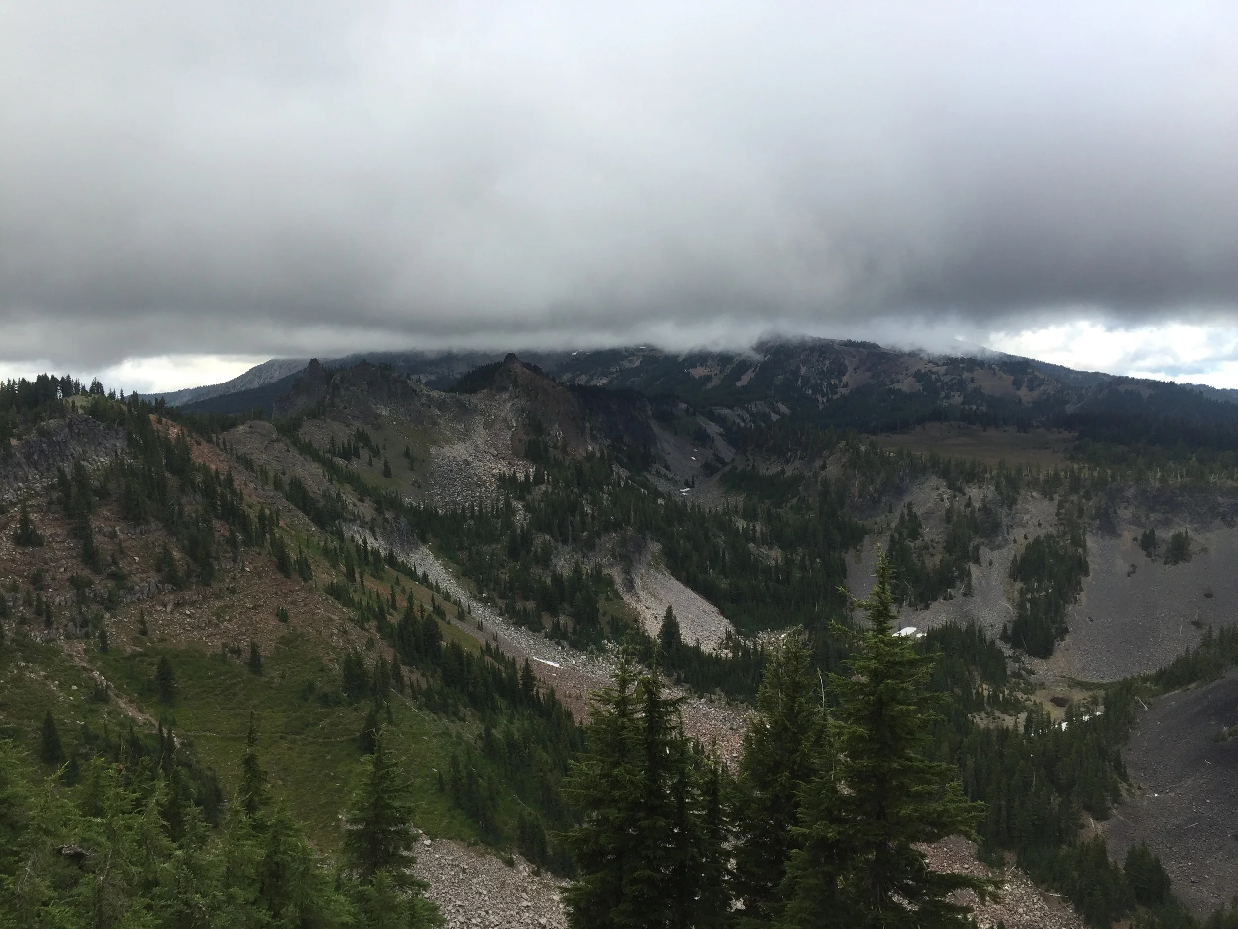
There is supposed to be a mountain there...
The trail skirted Jefferson's western slopes, and I finally set my tent up as it was getting too dark to see. This will be the first night in over a month that the rain fly is on, as the clouds never dissipated, and continued to look threatening. Glad I didn't forget how to put it on.
Day 96: mile 2025.1 - 2060.0
- Jefferson Park
- Rain!!!
- Rain...
Turns out the rain fly was unnecessary, as things cleared up and gave way to some awesome stars. Milky Way included. But by the time I was packing up and getting ready to hit the trail, the cloud cover had returned, once again hiding Mount Jefferson...
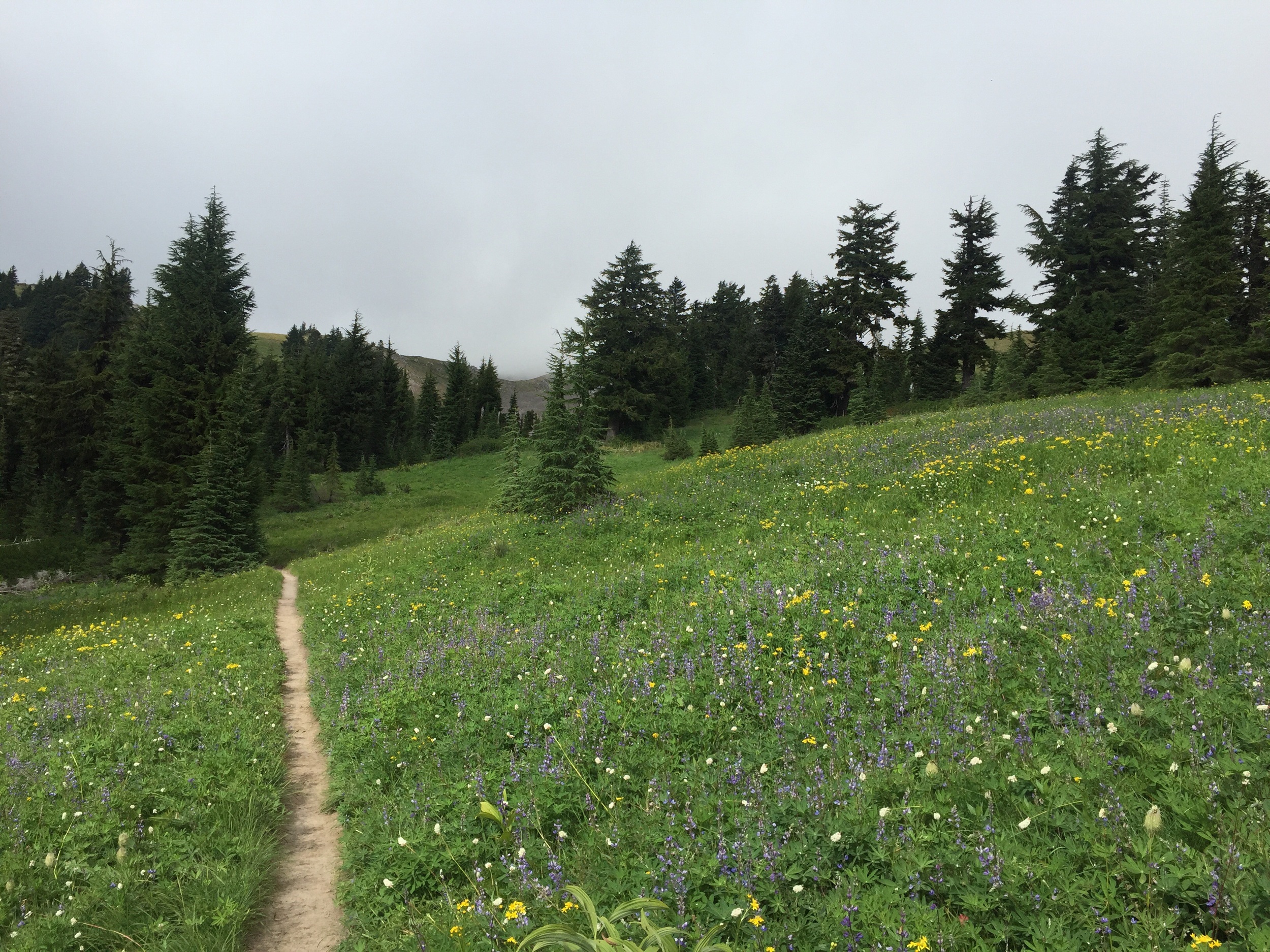
Eight miles in and the trail was squarely on Jefferson's northern side, going through what is called Jefferson Park. It is a big flat, filled with meadows, lakes, streams, flowers, and had what I'm sure are awesome views of the mountain, weather permitting. The clouds teased me all morning, but never lifted all the way. Jefferson Park is one of those places I would like to come back to, so maybe it was just saving its views for next time...

The reds of Jefferson Park

The greens of Jefferson Park

Overlooking Jefferson Park (and a shy Mount Jefferson)
As the trail plowed north, the clouds sunk lower. And got wetter. For the first time in over one thousand miles, my rain gear was put on. Then taken off. Then put back on. Then taken back off. Then put back on... It does a great job of keeping the rain off, but that means it does a very poor job of ventilating, so it's easy to overheat and get soaked with sweat while doing even moderate climbs. So I don't really want to wear it unless I need need need to. And the weather was giving me mixed signals as to whether or not I needed to...

Getting close and personal with the clouds
It was mainly walking through a tree tunnel for the rest of the day, with the views from the occasional clearing obscured by clouds. I know Mt. Hood is looming to the north, so fingers crossed that it makes an appearance tomorrow!

Beauty in the burns
Day 97: mile 2060.0 - 2094.5
- Look both ways before crossing the street
- Mt. Hood
Even though I couldn't hear raindrops for most of the night, I woke up to a very wet world. My shoes hadn't completely dried out, and my clothes were still damp-ish. But I had a dry pair of socks, which (even if they weren't going to stay that way for long) made it muuuch easier to get dressed.
My trekking pole made a rare appearance this morning, though not in its typical role to help cross creeks or traverse snow faces. Today I was using it to beat the water off of the bushes alongside the trail *before* my body brushed up against them. I have learned that wet shrubs alongside the trail will soak me quicker than even a heavy rain. Ideally I would have a hiking partner and politely ask them to go in front of me, but I guess a trekking pole is the next best thing.

Hiking through the mist
The morning and early afternoon were spent walking through trees and a light mist. There were a good number of road crossings as well. At the first paved crossing there was an RV parked near the trail. As I was checking it out (to my left) I started crossing the road. I made it a few steps onto the pavement before I realized that I hadn't looked to the right (you know, that whole "look both ways before you cross the street"). My head snapped around and I'll be damned if there wasn't a car barreling towards me. I wasn't close to danger, but still jumped back to the shoulder (probably the quickest I have moved in like a month) and waved at the car as it passed, with a "I swear I'm normally smarter than that" grin on my face. I'm going to have a hell of a time adjusting to society again.

Clouds still aren't cooperating
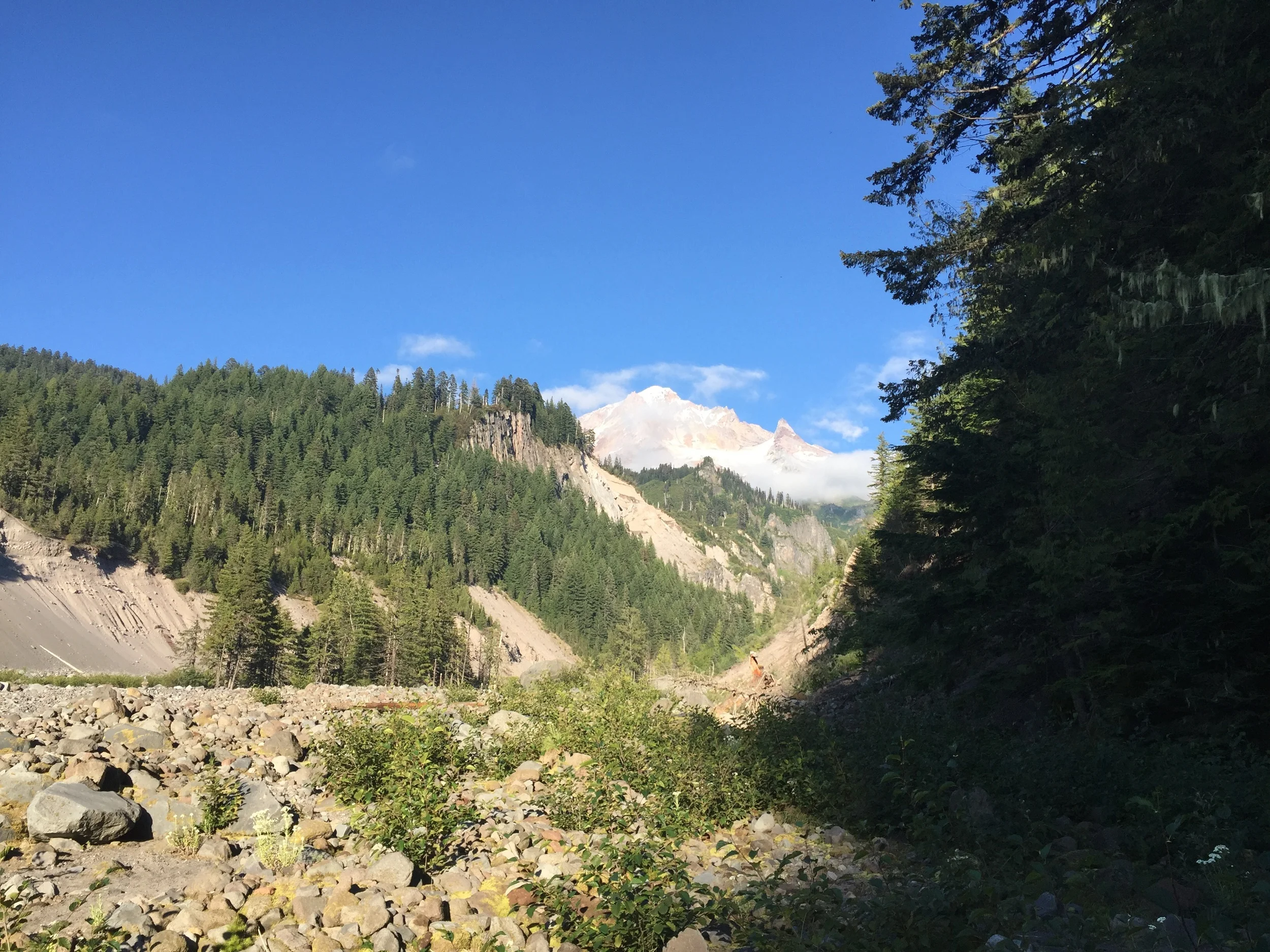
The clouds and mist kept Mt. Hood hidden, but it couldn't hide forever. After entering the Mt. Hood Wilderness the trail starts up Mt. Hood's southern slope. We knew there was this 11,000' mountain looming just ahead of us, but it wasn't until we had climbed to almost 7,000' that the clouds broke juuuuuust enough to give us a peek of the peak.

There it is!
My next resupply is at Timberline Lodge, a ski lodge and resort on the slopes of Hood. There were sheltered campsites about a tenth of a mile from the lodge, which is where I (and about seven others) decided to throw down for the night. Apparently they filmed a horror movie at this lodge, so this is one night I don't mind camping close to others...

There is a ski slope up there somewhere...
Day 98: mile 2094.5 - 2108.8
- Timberline Lodge
- Food coma
- Stay on the trail, Garrett
It didn't take me long to get dressed and wander down to the lodge. Their all you can eat breakfast buffet is LEGENDARY among PCT hikers, most people believing it is the best breakfast on the trail. At $15.95, I'm pretty sure I am going to come out on top of this deal.
Timberline Lodge was built during The Great Depression by the Works Progress Administration, and it is one hell of a building. It has a massive hexagonal lobby that spans two floors, with a fireplace in the middle and all sorts of comfy seats sprawled throughout. I was thinking about treating myself to a room here, but one look at the price tag and ended up deciding against it.

Timberline Lodge, with Mount Jefferson poking out of the fog
Breakfast was everything I imagined it would be. My first plate was cheesy scrambled eggs, frittata, ham, sausage links, and potatoes. Plate two was raspberry and chocolate chip pancakes, three sausage patties, and more frittata. Plate three was a Belgian waffle. Then I finished with a bowl of fruit and a berry smoothie, to try and trick myself into thinking it was a healthy breakfast. So. Much. Good. Food.
I had strategically decided to not break camp this morning before going to breakfast. The thinking was that I might eat so much that I would want to take a massive nap, in which case I would much rather nap in my tent that in the lodge lobby. It may have been a self-fulfilling prophecy, but that breakfast put me straight into a food coma. I waddled back to my tent, pulled my buff down over my eyes, and blacked out.
About three hours later I woke up. I laid there for another hour thinking about how I should get up and take care of my resupply before getting a few evening miles in. Finally I pulled the plug on my air pad and started to move, albeit slowly. By the time I was taking my first steps on the trail it was about 3pm. Not my earliest start ever...
Cool, green hillsides

Mount Jefferson once the fog (and my eyelids) had lifted
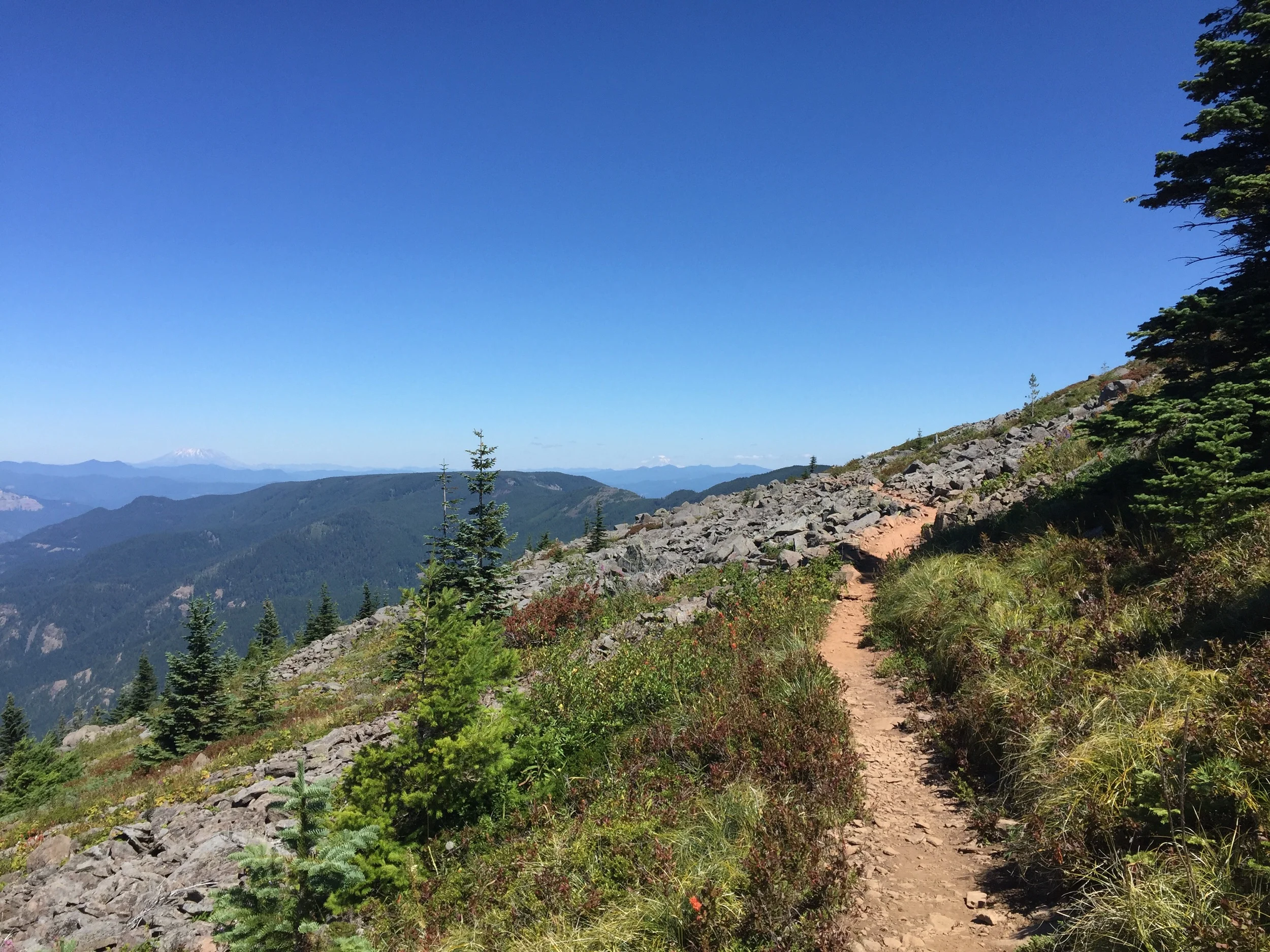
The trail was supposed to be easy - it went down for a few miles, then a little bit of up, then a whole lot of down. About five miles in, I was sweating like a dog towards the end of a looooong climb. As I got to the top I thought "huh, I don't remember seeing anything this long or steep on the elevation profile". I pulled out my GPS to see what mile I was at, and it gave me the bad news that I was over half a mile (as the crow flies) off-trail. Well shit. It's going to be tough to get to Canada if I can't stay on the right trail. Some days I'm amazed I have made it this far.

Mt. Hood (from my "alternate" trail)
Mt. Hood (from the actual trail)
I lucked out and the side trail I had ended up on was actually a loop that tied back in with the PCT (after a few extra miles and several hundred feet of additional elevation gain). Could have been worse. Once I got back on the right trail, I hiked until it was too dark to see before setting up camp. My appetite had finally returned for dinner, but I was impressed at how big of a dent that buffet had put in it. I'm going to have to dig a massive cathole tomorrow...

Ramona Falls
Day 99: mile 2108.8 - 2144.4
- Eagle Creek Alternate
- Cascade Locks
It was back to my regularly scheduled programming of coconut milk, granola, and protein powder for breakfast this morning. It didn't fill me up quite like yesterday's breakfast did...
The first fifteen miles were mainly forested, with occasional views of Mt. Hood (now to our south) and Mt. Saint Helens, Mt. Adams, and Mt. Ranier (all to the distant north). It is pretty cool to see miles of these smaller, heavily wooded hills, and then all of the sudden, BAM, you have this massive snow-capped volcano jutting out of the landscape. I can see why people love the Pacific Northwest.

Looking back at Mt. Hood
North towards Mount Saint Helens and Ranier

And Mt. Adams
The last fifteen miles of the day were on the Eagle Creek Alternate, which bypasses about 20 miles of PCT, but is taken by most hikers, as it is supposed to be much more scenic. You lose elevation in a hurry, and for about a mile it felt like we were hiking through a jungle, with cool, damp undergrowth, and water crossing the trail around every corner. Then it started to get much warmer and drier as we walked down the bottom of a canyon, with a brief respite from the heat coming in the form of Tunnel Falls. Those falls were absolutely stunning, and tall enough that my phone couldn't capture them in one shot.

The top half of Tunnel Falls

The tunnel behind the falls
Then it was all downhill to Cascade Locks, with the trail occasionally skirting steep cliff faces with a cable bolted to the mountain to hold on to. A (day) hiker died a few weeks ago on one of these stretches, so it wasn't something to be taken lightly (that bit of information is something you tell your parents *after* you survive it).
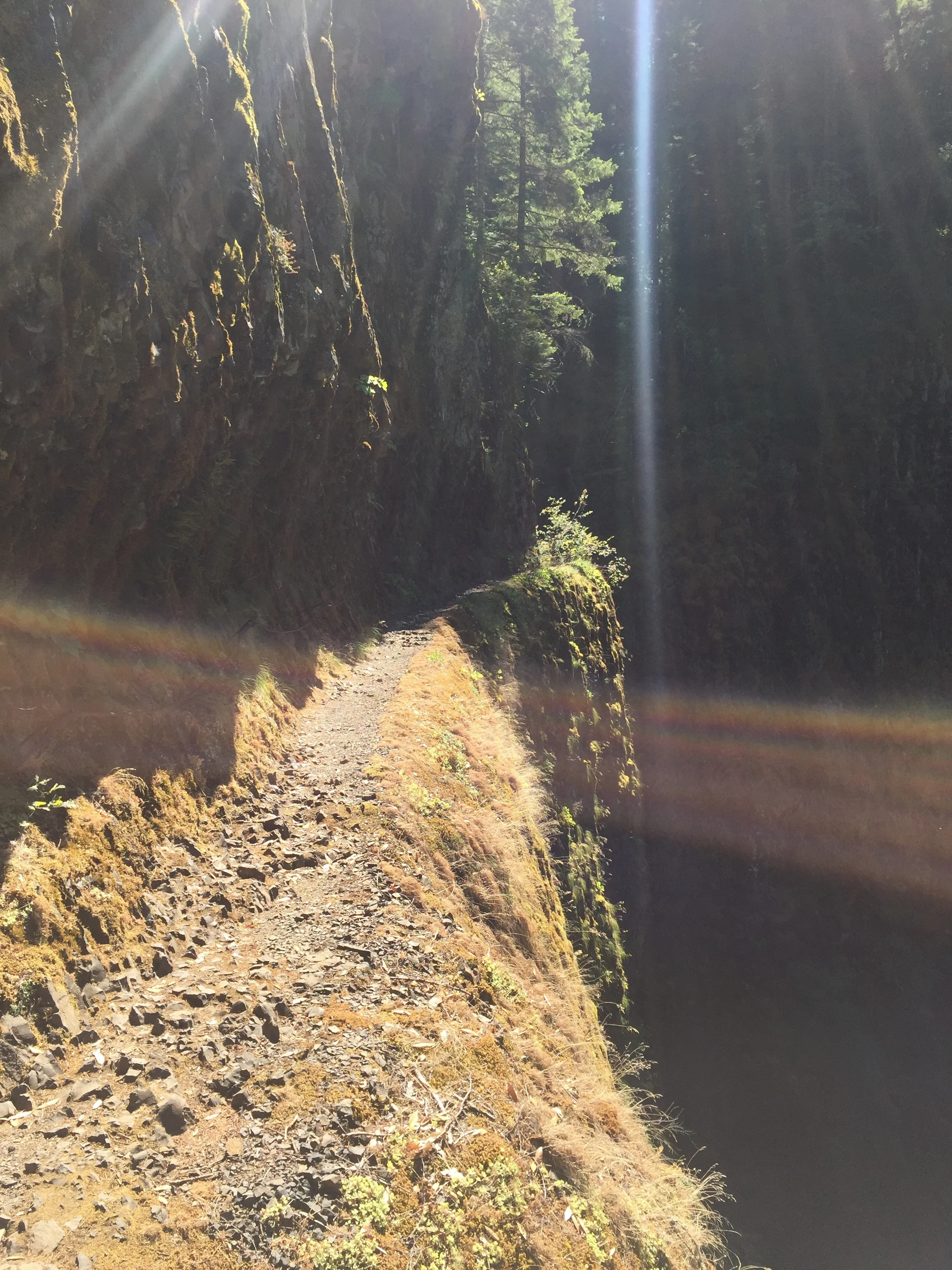
Okay, don't wander off the trail here, Garrett
Cascade Locks is in the Columbia River gorge, just before the trail crosses in to Washington. So for all intents and purposes, we are now done with Oregon. Two states down, one to go. We'll celebrate with some beer and food tonight, then get back on the trail tomorrow to start chipping away at the last five hundred miles. Home stretch baby!